Associated risks to property deals
Published on
Overview
Properties in Dubai are evaluated not only by price indices but also by comprehensive assessments of environmental, economic, transport, and other risk factors.
Understanding critical factors, such as flooding, traffic accidents, and crime, is essential for making informed investment decisions. Foreign investors require detailed geo-analytical data to balance potential returns against risk exposure, while insurance companies rely on in-depth risk profiles to underwrite and support real-estate transactions.
GeoAnalytics delivers a holistic perspective on risk, enabling strategic decision-making.
Solving Risk-Management Challenges
To assess and select prime investment locations in Dubai, GeoAnalytics by Smart Indexes consider three core risk factors:
- Transport Accident Rate (TAR) — the most frequent incidents, updated regularly.
- Average Crime Rate (ACR) — medium-frequency incidents, with frequent data refreshes.
- Flood Risk — low-frequency, weather-dependent events (annual occurrence varies).
Because TAR and ACR depend directly on residents’ activities, their data are updated more often than flood-risk data.
Range of Available Risk Indexes
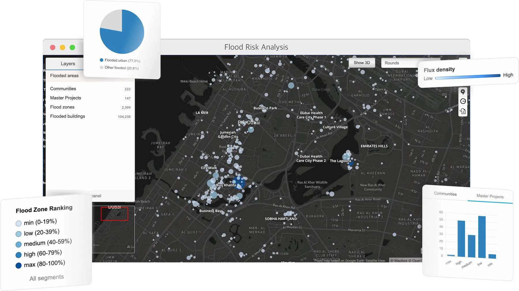 User interface of Flood Risk Analysis on GeoAnalytics map.
Each index is visualized on the map, allowing users to pinpoint areas that offer the optimal balance of low risk and high capitalization rate (Cap Rate) or return on investment (ROI).
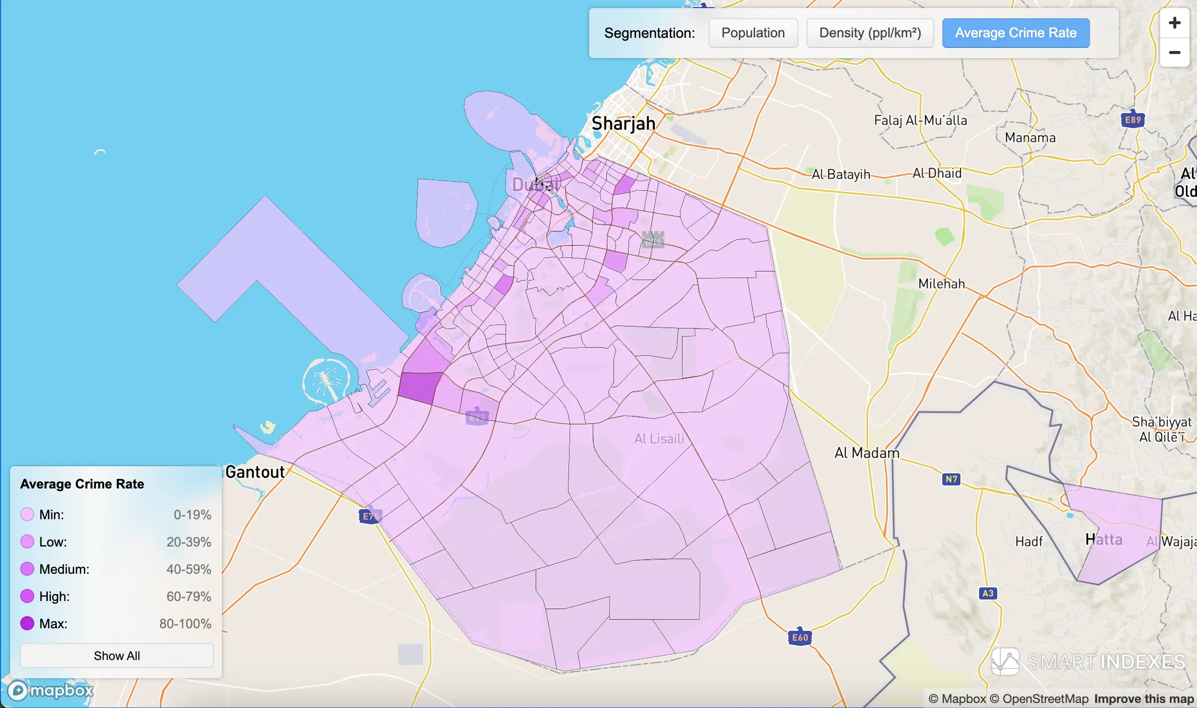 Color segmentation on map by Average Crime Rate of Dubai's communities in its administrative borders
The Transport Accessibility Score and Traffic Accident Rate indices show the positive and negative sides of the locations of buildings selected for geo-analysis of Dubai communities.
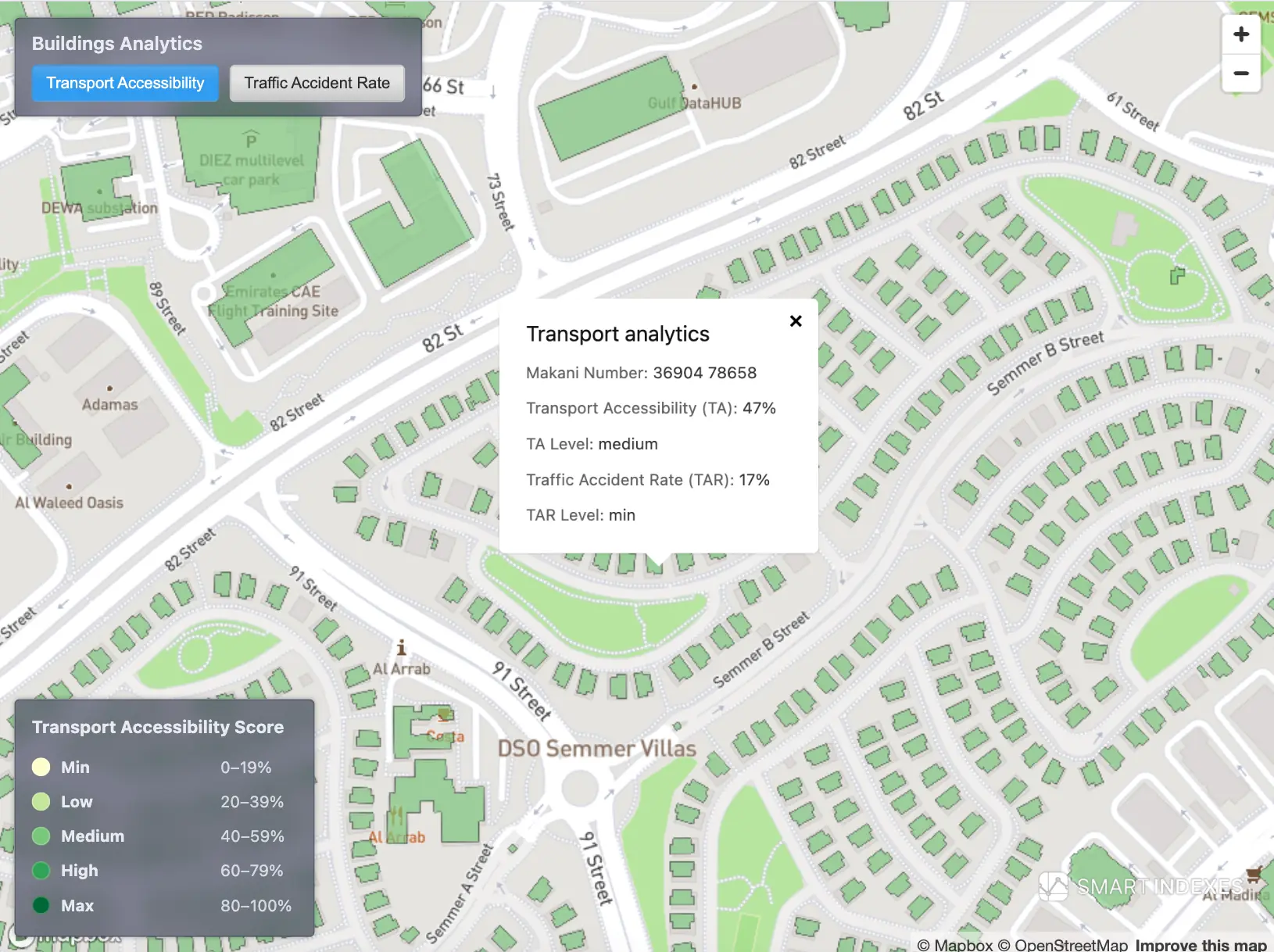 Transport Accessibility Score on Dubai's map based on Makani Number and nearby transport hubs
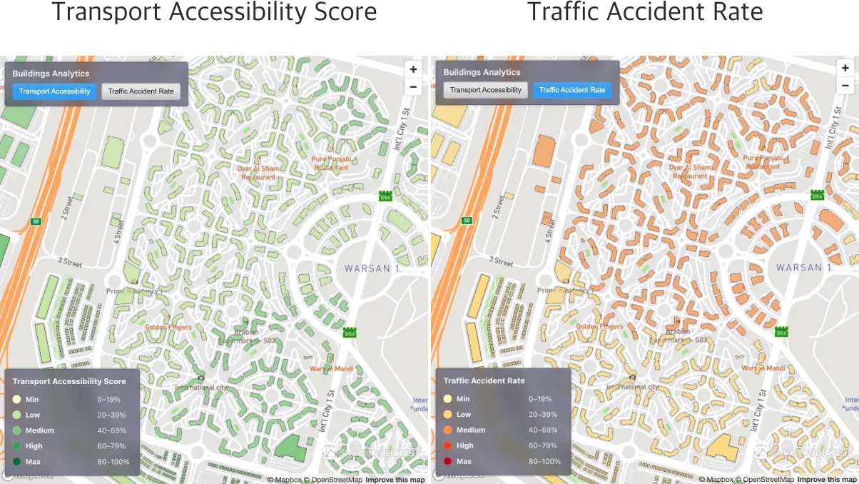 Transport Accessibility Score vs. Traffic Accident Rate on same location in community Warsan 1 of Dubai.
- Transport Accessibility Score is a combined index of transport accessibility, including an assessment of the proximity of metro stations to the entry point to the building (Makani Number), the distance to electric charging stations (EV Charging Stations), the airport and the risk of an accident (by community).
- Traffic Accident Rate is a risk index for assessing the number of accidents within a radius of 1 km over a long period, for example, per quarter, half-year, year.
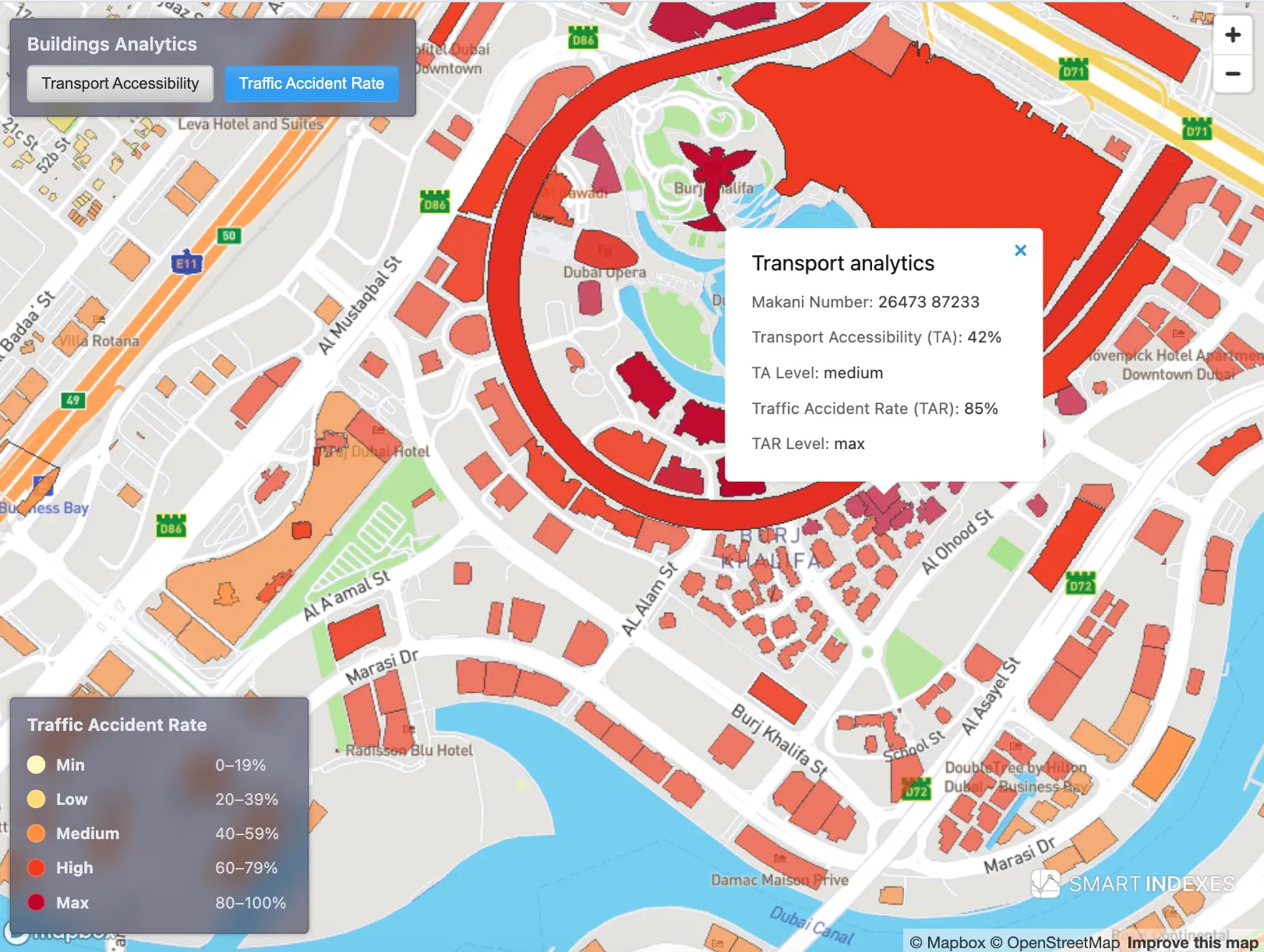 Traffic Accident Rate on Dubai's map based on Makani Number and registered nearby traffic incidents
Flood risk research of the Emirate of Dubai based on meteo events of April, 2024.
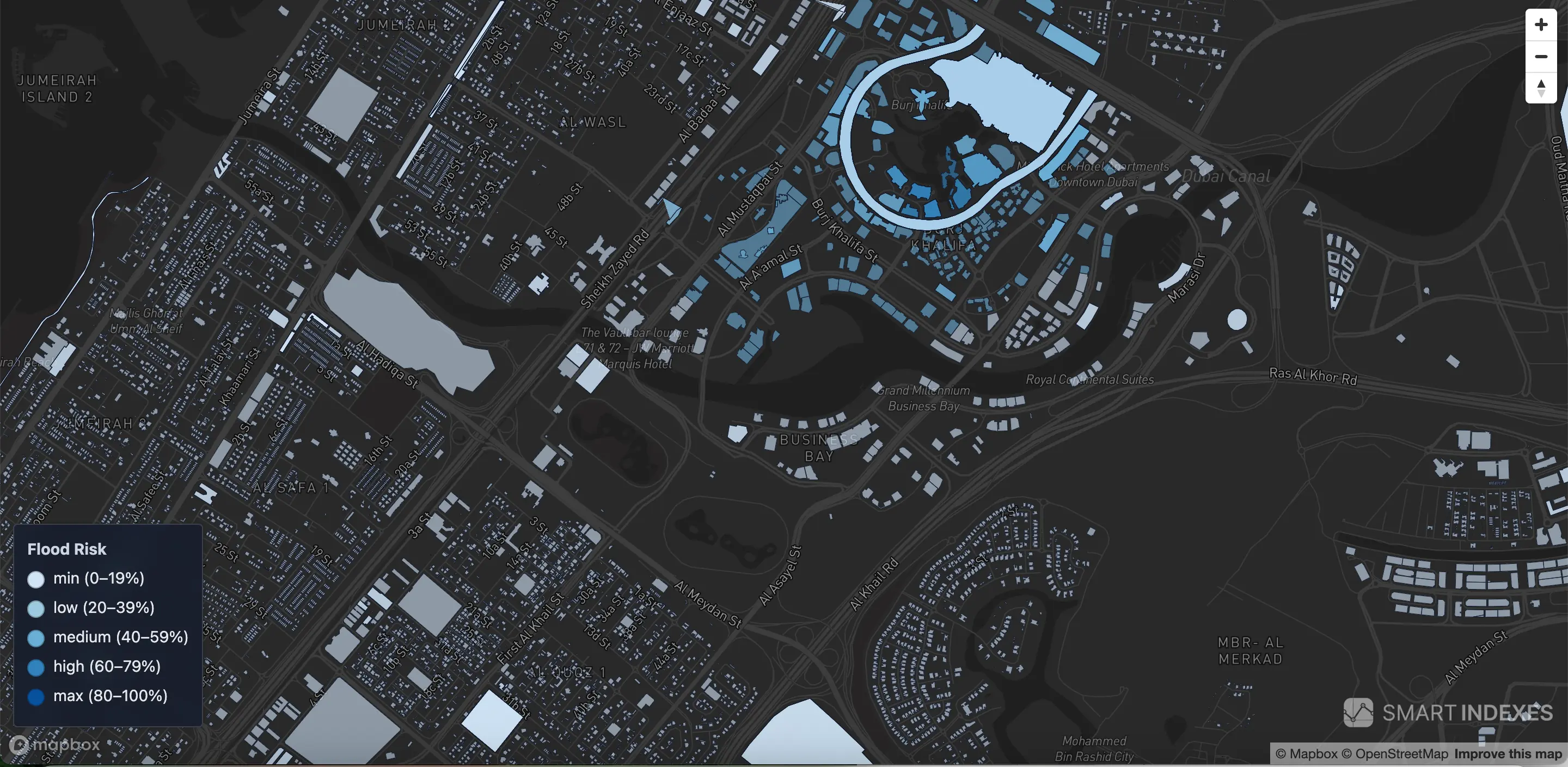 Color segmentation of flood risk for buildings in Dubai based on counted flooded area in radius 1 km from building entrance (Makani Number)
Risks in GeoAnalytics
Risk overlays are available under Property > Summary > Risks on the Dubai map.
Also available in section Investment Analysis > Associated Risks.