Welcome to Smart Indexes Video Presentation
Time:
►
Cross-Platform GIS GeoAnalytics
Browser-based web application for online use
The Smart Indexes GIS product for geospatial analysis and property selection in the Emirate of Dubai for corporate users on Windows and MacOS.
About GeoAnalytics
Smart Indexes presents the GIS product GeoAnalytics—geo-solutions for the real estate market of the Emirate of Dubai, UAE, powered by data science.
Grow your business with deep geospatial data analysis and gain a competitive edge.
Benefits of GeoAnalyticsby Smart Indexes
Smart Indexes ▶ Geoanalytics Benefits for Real Estate Businesses
Cross-Platform Application
Accessible on Windows and MacOS via Google Chrome, Safari, and Mozilla Firefox.
Private Secure Access
Authentication via a protected private token link.
Comparative Property Analysis
Automated building comparisons in Dubai with AI-driven strategic recommendations.
Property Segmentation
Gradient and heat segmentation by price indices, ABC classification, and more.
Developer Rankings
Dubai developer ratings based on a comprehensive reputation index for optimal selection.
Custom Filters
Step-by-step filtering of developers, residential, and commercial properties in Dubai.
Report Manager
Customizable manager for generating up-to-date, comparative, and risk reports on target topics.
Flexible GeoAnalytics Interface
Interface settings include measurement units, map theme, and other parameters.
Smart Indexes ▶ Solutions for Analysts and Business Consultants
Map-Based Visualization
Segmented maps of the Emirate of Dubai and filters instead of charts and tables for geoanalysis tasks.
Increased Productivity
Accurate analysis of client needs by location to optimize business processes.
Authentication via secure token link.
Integrated Risk Insights
Geo-dependent meteorological and social risks linked to communities, master projects, and properties for balanced real estate pricing.
New Digital Products
Integration of geoanalytics into applications ranging from risk management to Smart City solutions.
Expanding Retail Markets
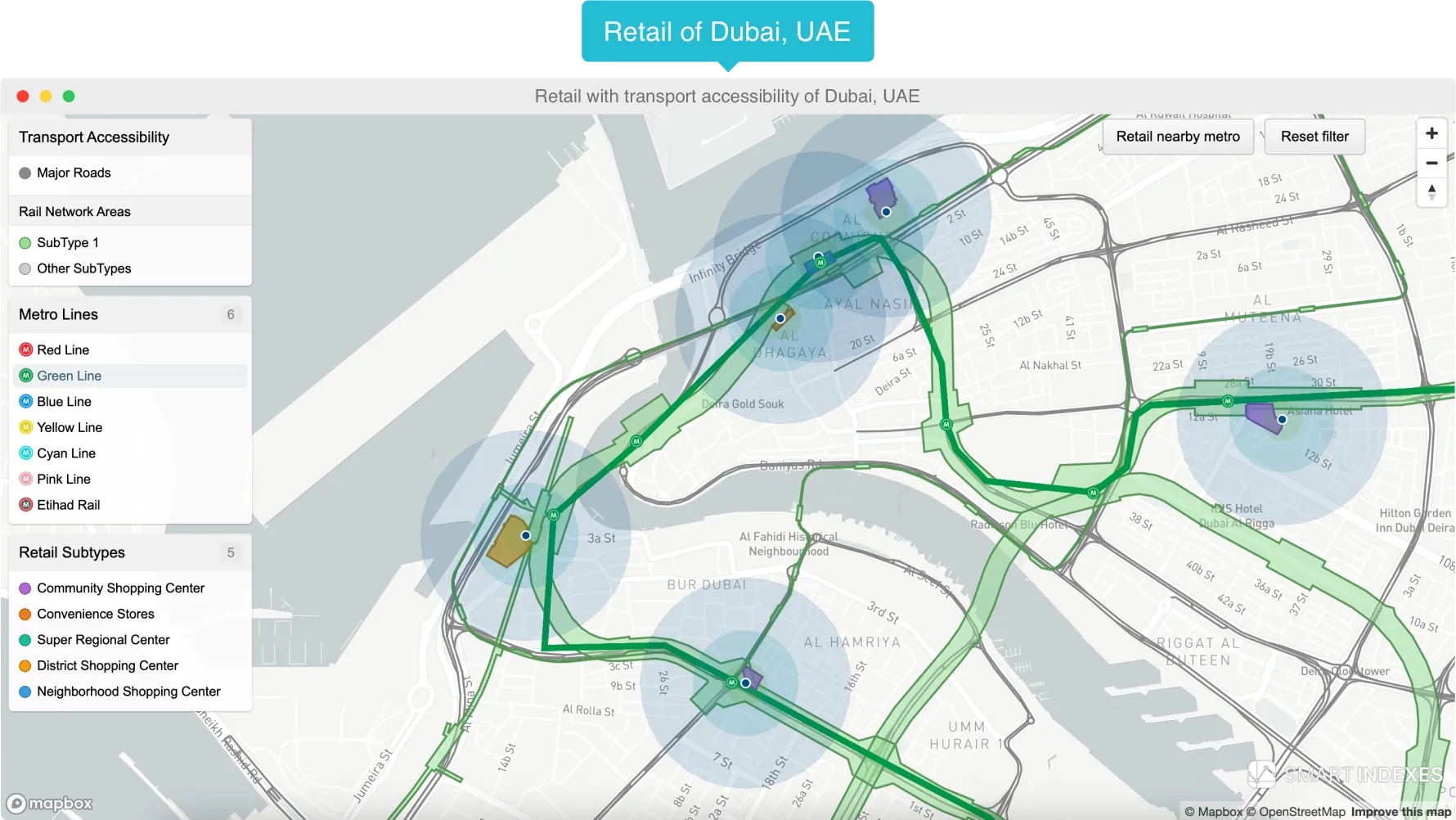
Identifying promising retail zones and complexes based on transport accessibility, demographics, infrastructure, and economic indicators.
Real Estate Risk Management
Identifying optimal construction and investment locations using geoanalysis balancing flood, traffic, and crime risks.
What Your Company Gainswith GeoAnalytics
-
Satellite Data Analysis for Terrain Risk Assessment
Algorithm-driven terrain analysis provides essential geospatial data for comprehensive geoanalytics and strategic decision-making.
-
Tailored Enterprise Solutions
Corporate GIS platforms with advanced geospatial analytics for neighborhoods, master developments, and buildings; integration into your processes and scalable to any business needs.
Smart Indexes Servicesin Geoanalytics for Dubai Real Estate
Custom Geospatial Software Development
Scalable Big Data processing solutions, edge computing for real-time analytics, and cloud platforms for storage and analysis.
GeoAI: Data Science for Business
AI algorithms and data pipelines for automated object recognition, land-use classification, and predictive modeling.
Satellite Image Processing
Automated preprocessing: ingestion, alignment, noise reduction. Pattern extraction from crop forecasts to infrastructure risk assessments.
Big Data Mapping and Visualization
Interactive maps with multi-layer geoanalytic data, terrain models, and real-time geoanalysis dashboards.
Big Data Geoanalyticsin the Global Market
The Smart Indexes team presents key statistics on the global geoanalytics market.
Geoanalytics MarketKey Statistical Facts
- In 2025, the global geoanalytics market was valued at $102.45 Billion.
- By 2030, it is projected to grow to $226.53 Billion.
- A projected CAGR of 11.3% between 2025 and 2030.
GeoAnalyticsThe Foundation of Strategic Growth in Proptech Real Estate
Geoanalytics combines the collection, processing, and visualization of GPS, coordinate, and remote sensing data. Use mobile sensors and built-in devices to gather geodata, then transform it into clear maps, charts, and reports.
User-Friendly Interfaceof the GeoAnalytics Digital GIS
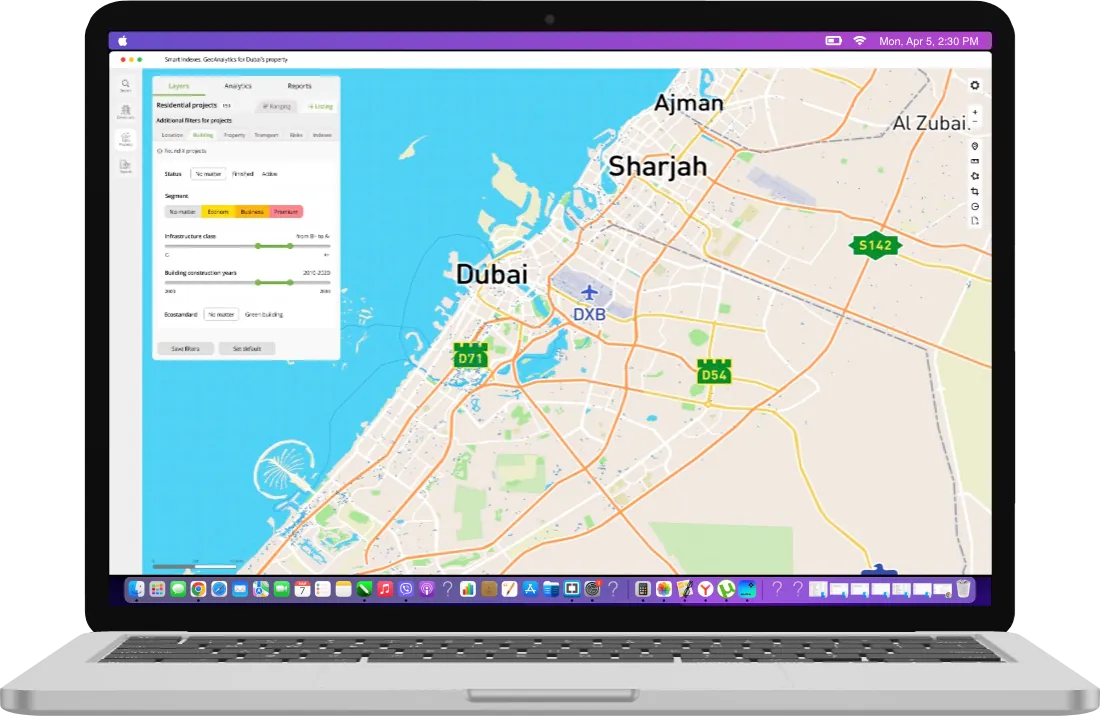
The GeoAnalytics web interface is a full-featured GIS application built on MapBox, with a suite of tools for in-depth geospatial analysis. The interactive map provides key geospatial data for the Emirate of Dubai: district boundaries, communities, buildings, transport hubs, and other thematic layers with analytical insights.
Useful Toolsfor Geoanalysis on the Dubai Map
Radius search, points of interest, click-to-info on map objects, and other tools are available in GeoAnalytics for daily operations and in-depth location analysis in Dubai.
Dubai Geodata Layersfor Location Geoanalytics
The GeoAnalytics GIS product provides navigational search and specialized analytics on the Dubai real estate market: developers, buildings, transport accessibility, and associated risks.
Available Dubai Geodata
Examples of available geodata for Dubai, UAE.
-
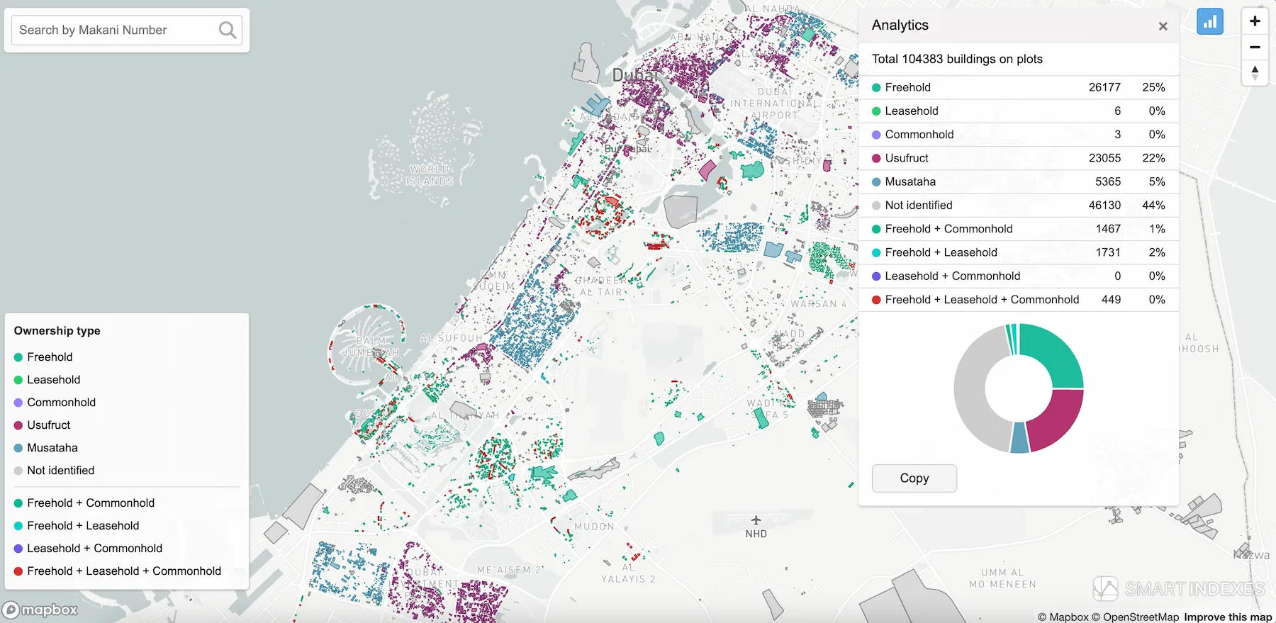
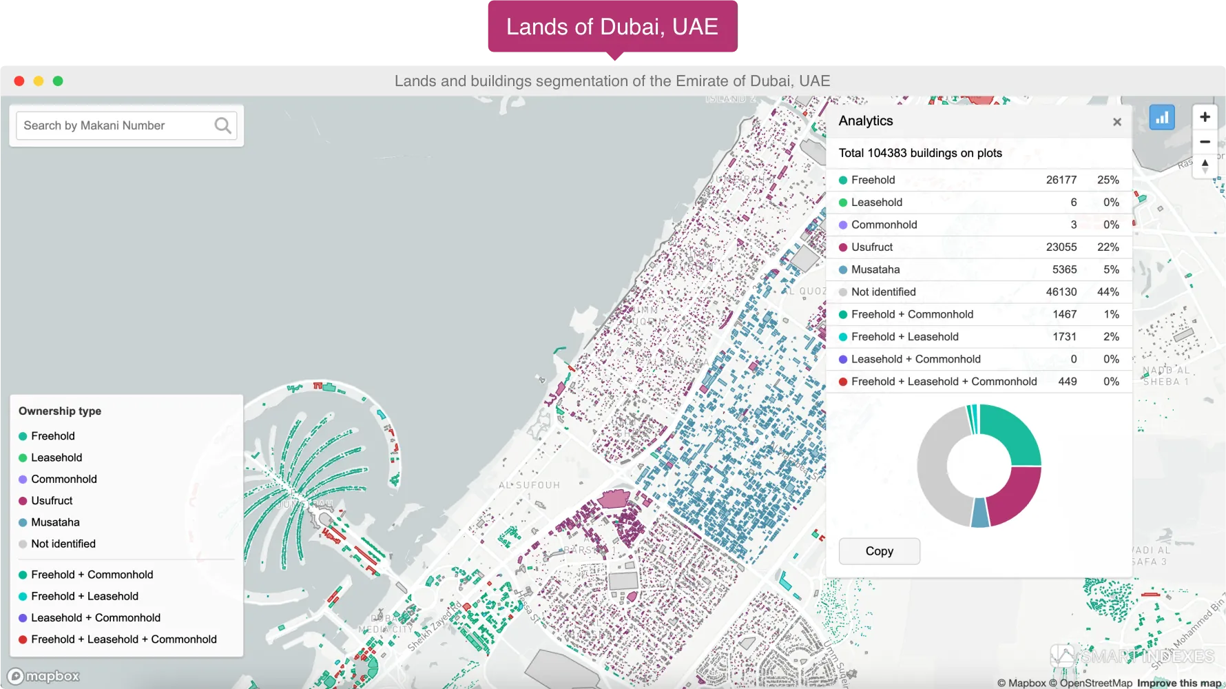
Land Parcel Segmentation in Dubai, UAE Analytical Geodata -
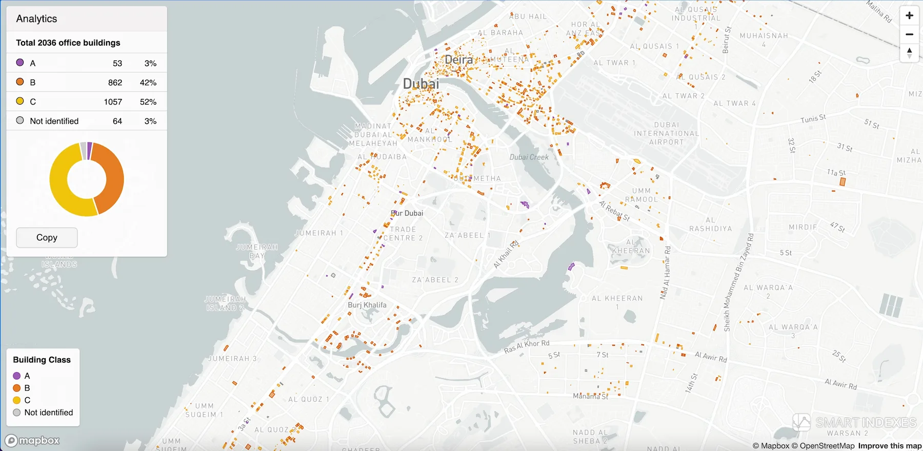
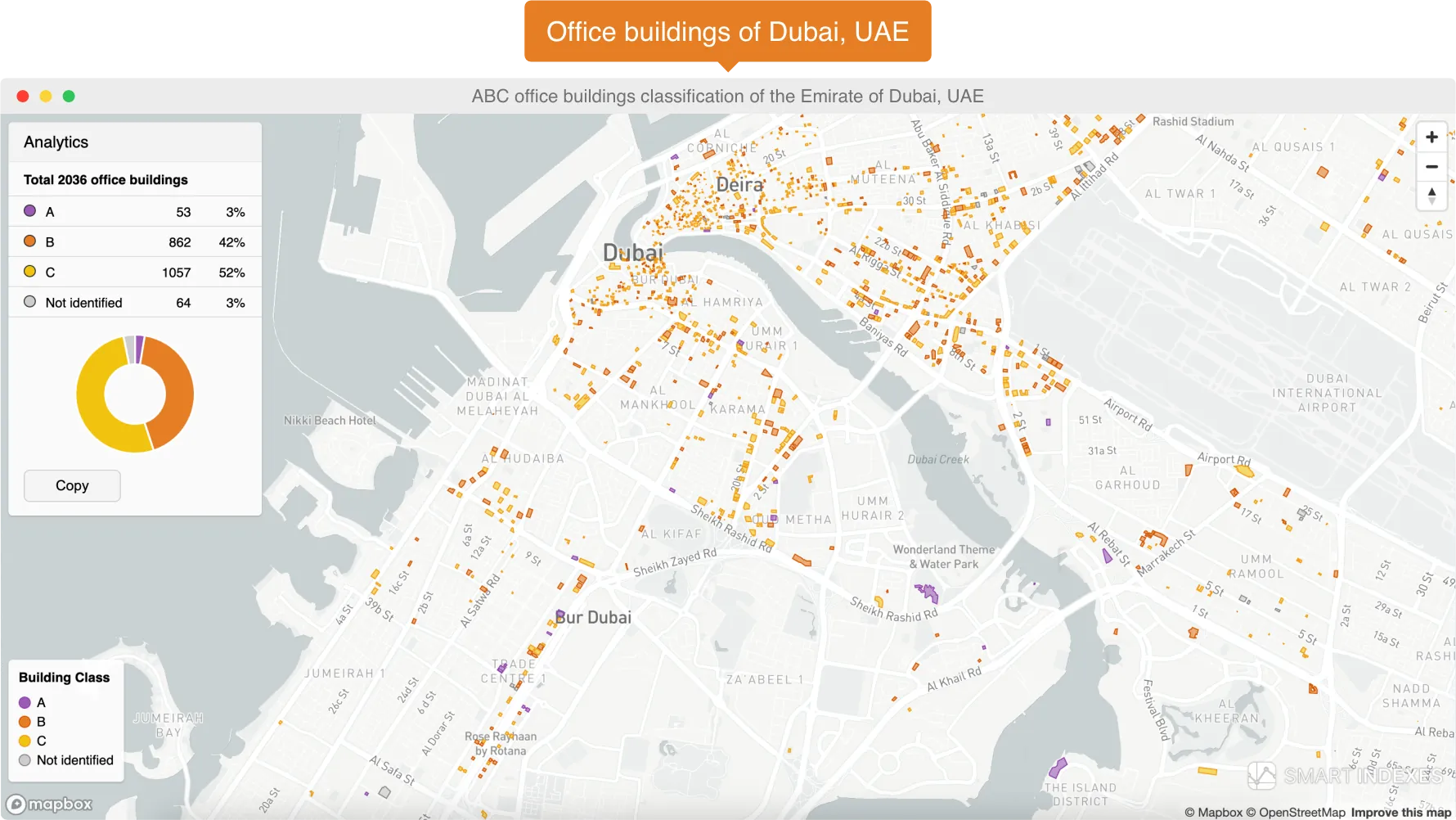
ABC Classification of Office Buildings in Dubai, UAE Analytical Geodata -
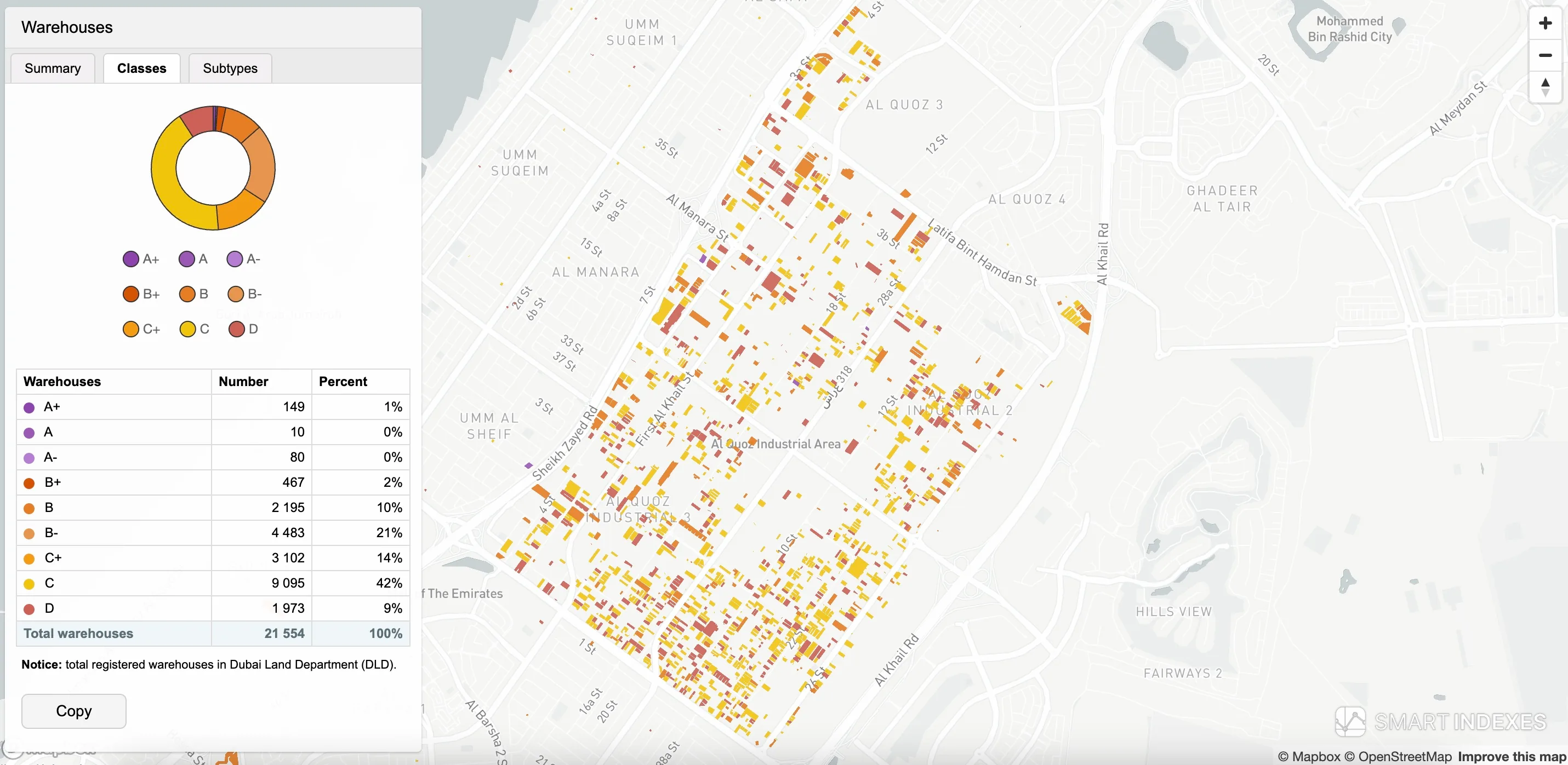
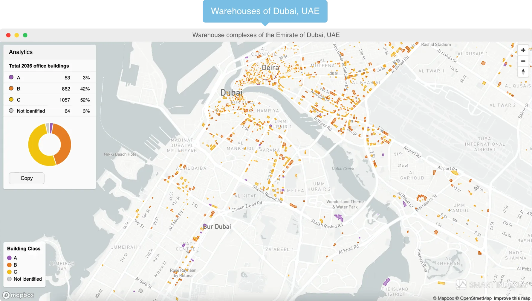
ABCD Classification of Warehouse Complexes in Dubai, UAE Analytical Geodata -
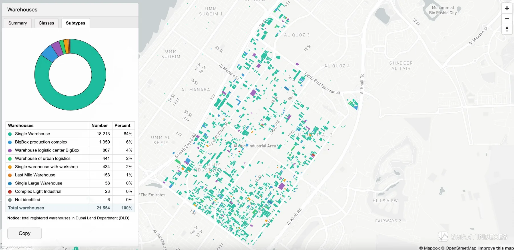
Subtype Segmentation of Warehouse Complexes in Dubai, UAE Analytical Geodata -
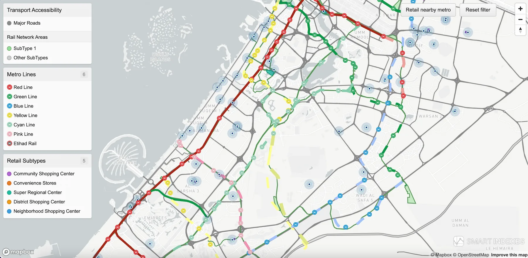
Retail Point Classification by Transport Accessibility in Dubai, UAE Analytical Geodata -
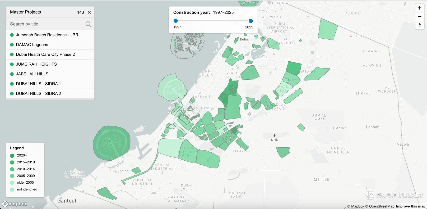
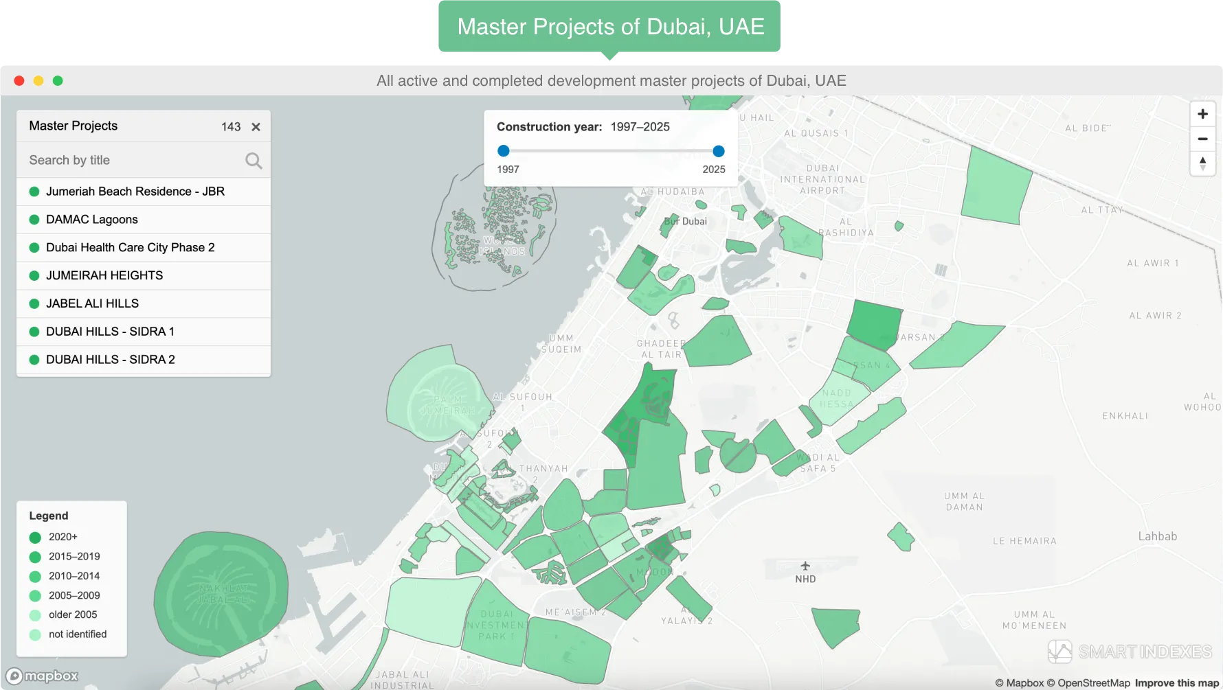
Master Project Filtering on the Map of Dubai, UAE Analytical Geodata -
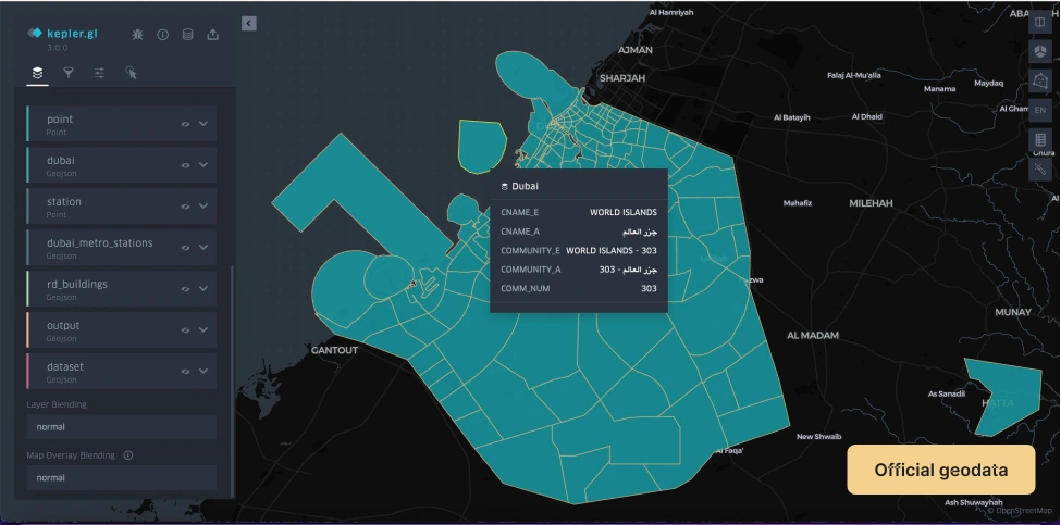
Community Boundaries of Dubai Official Geodata -
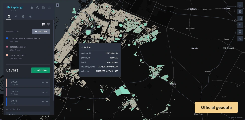
Building Footprints of Dubai Official Geodata -
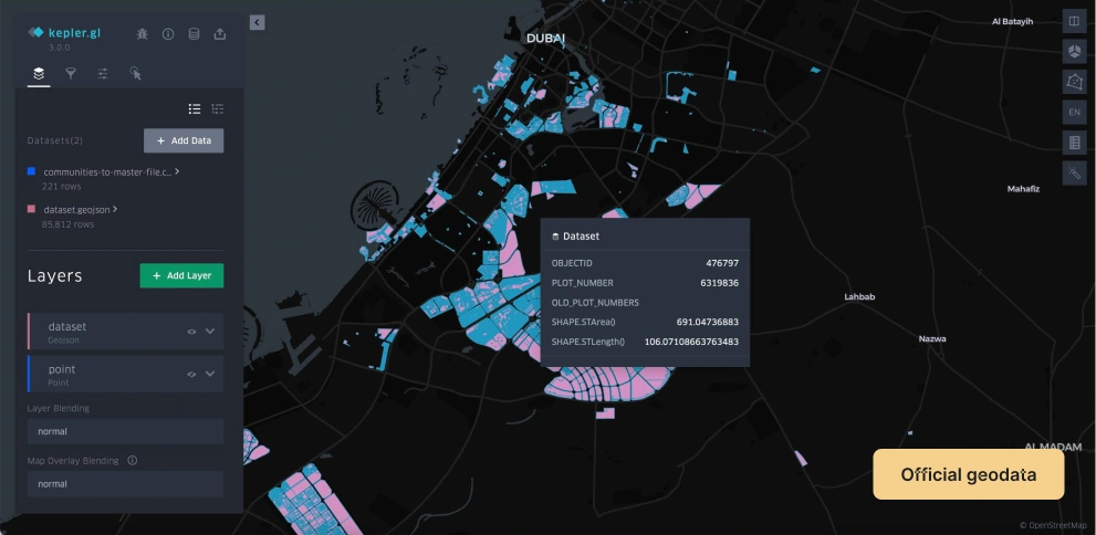
Master Project Outlines of Dubai Official Geodata -
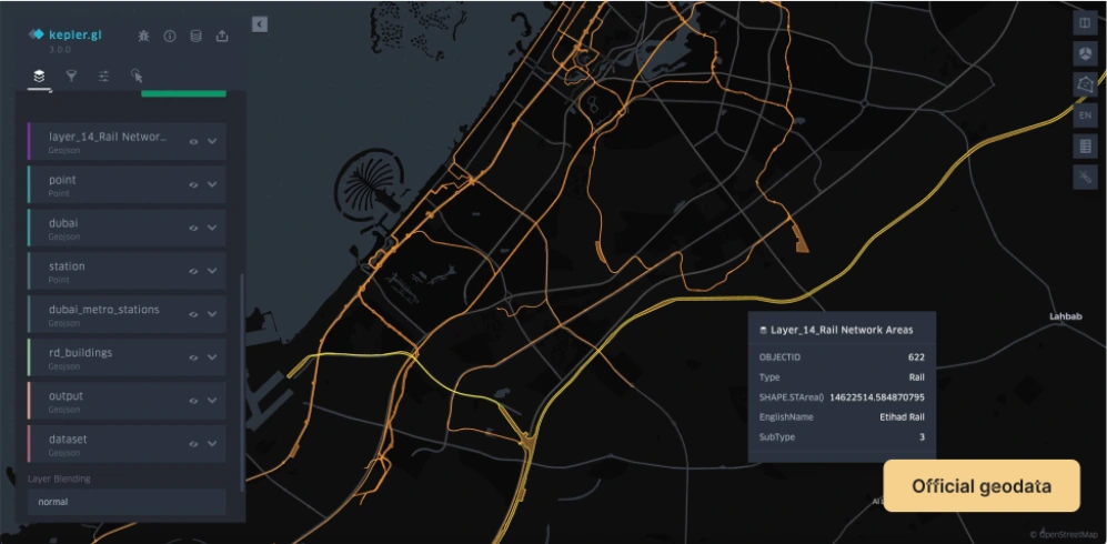
Major Roads of Dubai Official Geodata -
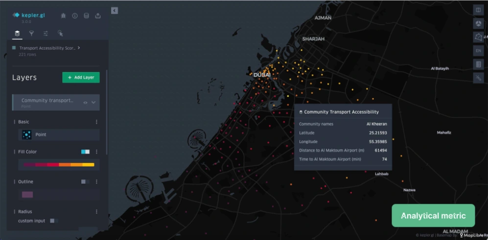
Transport Accessibility Score of Dubai Analytical Indicator -
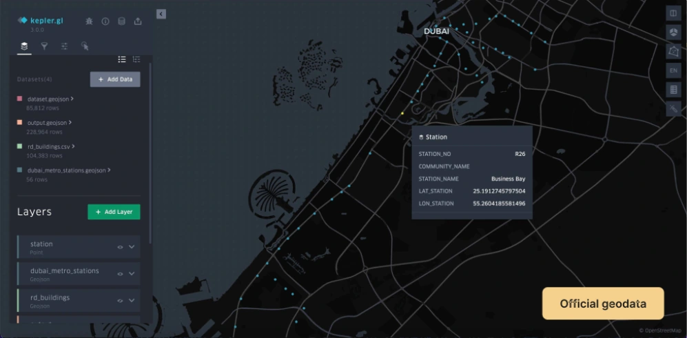
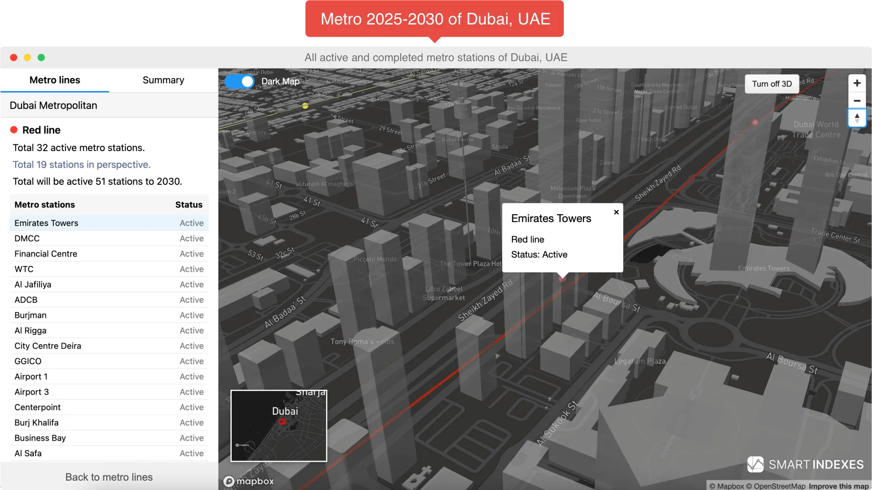
Metro Stations of Dubai Official Geodata -
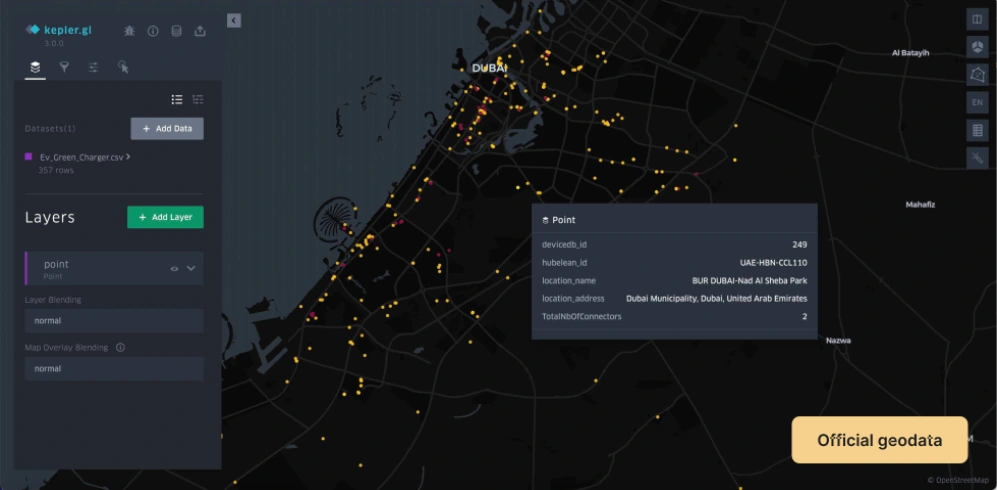
EV Charging Stations in Dubai Official Geodata -
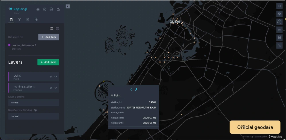
Marine Stations of Dubai Official Geodata -
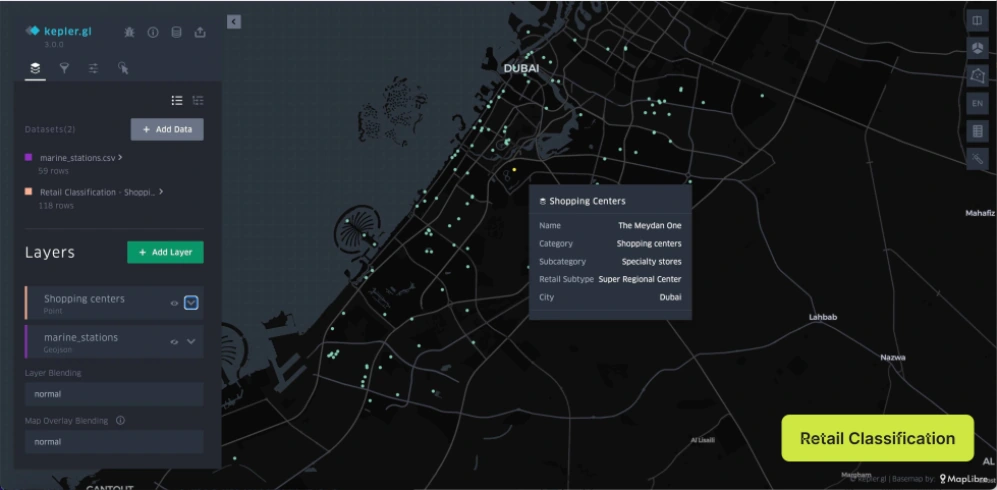
Retail Points of Dubai Official Geodata
FAQ
What GIS data sources do you provide?
Below is a list of verified data sources for our digital products and analytical reports:
Geospatial Layers
- Search on the map by address database: by Makani Number, by district, by master project, by development projects, by address in Dubai.
- Master plan: cadastral map with 15 layers.
- Sectors: perimeters, areas, lengths and coordinates of sectors.
- Сommunities: 3-digit numbers, full and short names, geocoordinates and boundaries.
- Building layer: polygons, Makani ID, Parcel ID, building names, addresses, communities, entry points.
- Demolition permit layer: building type, company, license number, plot number, permit number, date, demolition area, number of buildings.
- Master Projects Layer: JSON project polygons for MapBox integration.
- Highway Layer: Dubai's main road routes.
- Metro Stations Layer: IDs, zones, names (EN/AR), lines, coordinates, opening/closing dates, platforms.
- Bus Stops Layer: routes, stations, and related information.
- Railways Layer: platforms, tracks, tram stops.
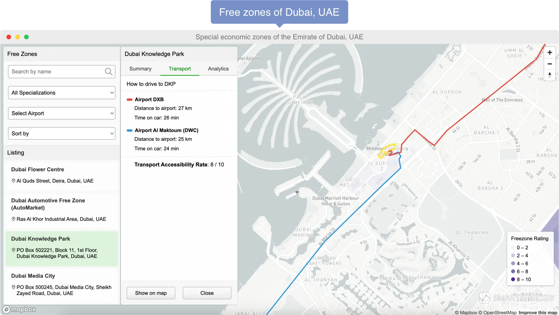
- Free Economic Zones Layer: names, descriptions, polygons, accessibility index, and routes from airports.
- Warehouse Layer: warehouse data from the DLD registry supplemented with analytics by warehouse class and its subtype of use.
- Risk Layer flooding: analytical data on flood risk by district.
- Transport accessibility layer: calculation based on distance to airports and facilities, score from 0 to 10.
This represents only a portion of the full dataset available upon commercial request.
Free PDF reports for communities, master projects, and buildings are also available.
Are the provided data verified?
All geospatial layers are validated by Dubai's official authorities:
- Dubai Land Department
- Dubai Development Authority
- Ministry of Economy, Dubai
- Dubai Statistics Center
Data is sourced directly from primary registries with state-level accuracy.
Analytical metrics are computed using distance, elevation, and other formulas via the MapBox API.
Is Smart Indexes a data provider?
Smart Indexes offers geoanalytics services and develops an extensive GIS platform with cadastral, transport, and flood risk layers.
With our solutions, you can:
- Request detailed reports on any parcel, building, or geo-object.
- Order studies on flood, crime, and transport risks for transaction audits or site selection.
Which projects benefit from Dubai geodata?
The use of GeoAnalytics is relevant for a wide range of companies and professionals.
-
For financial institutions
How to choose a developer in Dubai taking into account the investor's requirements. -
For insurance companies
How to analyze a property in a transaction and identify associated risks depending on its location in Dubai. -
For developer companies
How to check the market competition situation and the developer ranking on the map. -
For real estate agencies
How to conduct a comprehensive transaction with the analysis of the Dubai real estate market. -
For investment funds
How to perform a comprehensive analysis of the developer based on the factors related to the risks and indicators real estate. -
For logistics companies
How to find places with the optimal balance of transport accessibility and correct routing.
How are geodata and analytics delivered?
Data export formats: CSV, PDF, XLS, and Google Sheets.
API integration is available for corporate clients upon request.
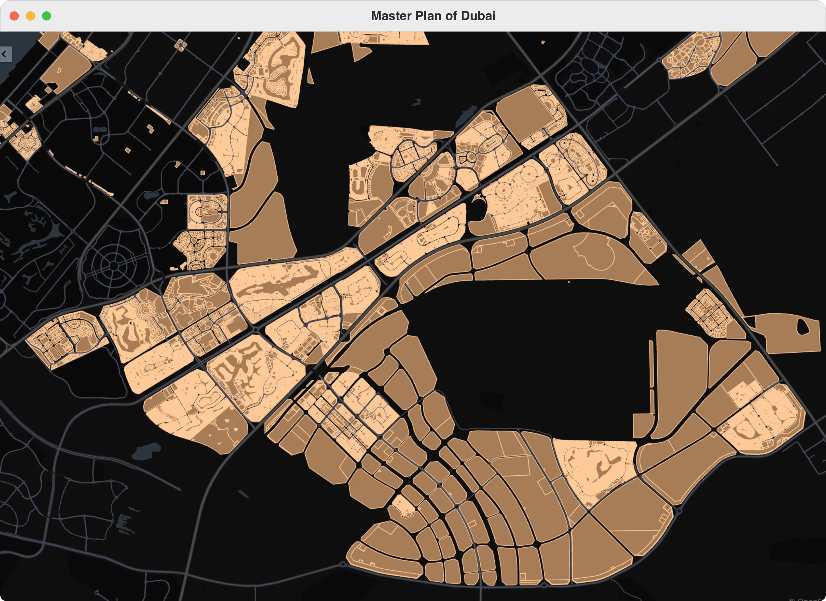
What is the Dubai Master Plan?
The Dubai Master Plan is a state cadastral map with 15 geospatial layers, supporting parcel search and PDF report generation.
- Parcel boundaries with coordinates and IDs.
- Full polygon geometries.
- Side characteristics and permissible heights.
- Allowed building lines inside cadastral limits.
- Arcades in commercial and tourist zones.
- Retail zones: malls, shops, markets.
- Road network: highways to local streets.
- Current land use per parcel.
- Regulatory restrictions per parcel.
- Public infrastructure layers.
- Green and recreational spaces.
- Multimodal transport infrastructure.
- Natural features and ecological areas.
- Points of interest (landmarks, attractions).
- Administrative boundaries for planning.
What is the reason for the high cost of Dubai Master Plan?
The Master Plan contains all the polygons of development sites and buildings currently built in Dubai (up to October 2024).
The high cost of the cadastral plan is justified by the full volume of geo- and physical data on all buildings and sites in Dubai registered on its territory.
How often are the geodata of the cadastral plan updated?
Cadastral geodata is updated monthly. If necessary, there is a commercial opportunity to provide updates every month based on changes in the Dubai cadastral plan.
How is flood risk calculated for areas in Dubai?
The flood risk calculation methodology is based on an assessment of the relative remoteness of Dubai's districts and their elevation relative to the level of the Persian Gulf.
The model used the distance from the center of each district to the coast and the district's elevation above mean sea level. Since Dubai is at sea level, with an elevation of about 16 meters (52 feet) above sea level, this point is important for calculating the likelihood of flooding.
Importance of flood risk based on meteo events like deluge in the Dubai, United Arab Emirates at April, 2024.
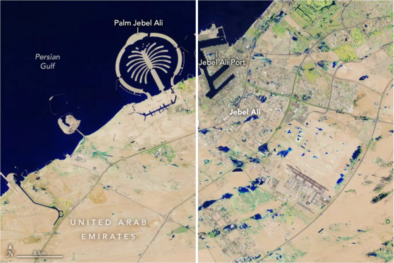
Source: Earth Observatory NASA
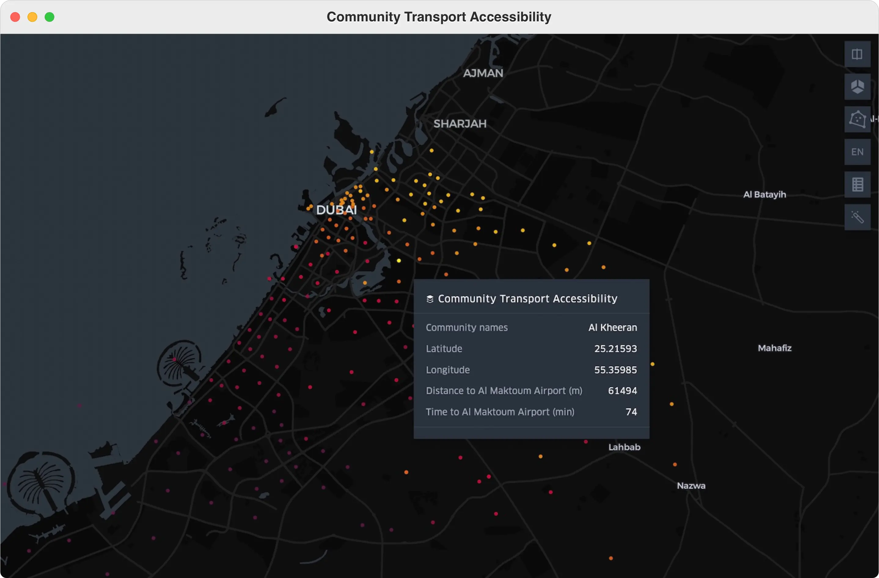
What method is used to calculate transport accessibility by districts of Dubai?
Analytical metric assessment of transport accessibility based on distance from two nearest airports and road distance to the airport from each community, major projects and buildings.
Scored from min. 0 to max. 10.
How is the average crime risk assessment for Dubai areas carried out?
The average crime risk assessment is based on Dubai's official statistics and is calculated by calculating the population density by area per sq. km as a percentage.
This rough analytical value focuses on the proportion of crimes in public places of public gatherings in Dubai.
Request demo of GeoAnalytics
Team of SmartIndexes are welcome to start the dialog about collaboration and commercial use of GeoAnalytics for implementation in digital products: navigation, VR, logistics and development, insurance, e.t.c.
Choose the request
Please select the request type for your first request to Smart Indexes.
Users' personal data is transmitted exclusively via a secure HTTPS connection to ensure confindiality.
Request feedback
Smart Indexes uses cookies to enhance your experience and tailor content based on our Privacy Policy.