Segmentation of Land Plots and Property by Ownership Type on the Map
This showcase is provided by Smart Indexes for informational purposes only. It demonstrates the capabilities of geoanalytics to address complex business challenges, including real estate investment in the Emirate of Dubai, using empirical data on land parcels and ownership types.
Technologies: Microservices JavaScript GeoJSON Mapbox
Investing in real estate in the Emirate of Dubai requires a thorough analysis of ownership structures — including land, buildings, and unit-level rights. Understanding these legal frameworks helps prevent future issues related to property use and commercial operations.
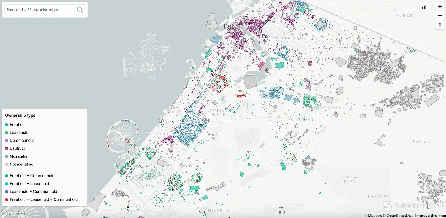 Geoanalysis by segmentation of land plots and property for ownership type on map
Overview
Comprehensive Dubai Pulse land-registry data is integrated into Smart Indexes’ geoanalytical map for ownership segmentation.
Important to understand
- Ownership rights apply to land parcels and may also extend partially or fully to the buildings constructed on them.
- Both land-parcel ownership and the rights attached to the buildings (residential, rental, or commercial) must be analysed.
- The Smart Indexes / Lands Segmentation map shows approximately 53% of all lands where buildings are constructed (104+ thousand) and it is possible to determine the type of ownership by registered in Dubai Land Department sales transactions and rent contracts.
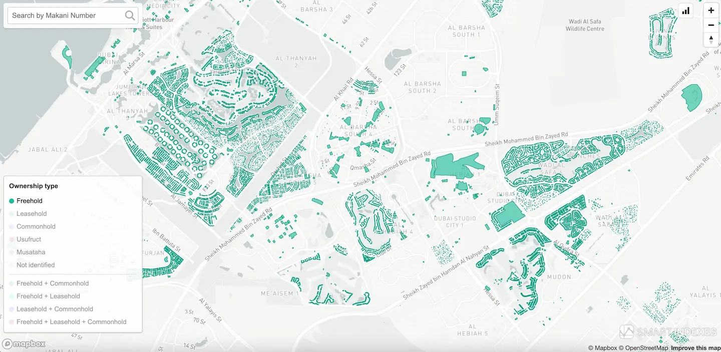 Chosen segment of freehold lands filtered to next geoanalysis on map
Task #1. Segment buildings by ownership on the map
-
Load the layer "Lands Segmentation" on map
After this layer is fully loaded, the user receives color segmentation on the terrain map with the polygons of the plots colored according to the legend on the map. -
Select the desired ownership type in the legend from the options offered.
Single ownership types:
- Freehold
- Usufruct
- Musataha
- Leasehold
- Commonhold
- Not identified
Mixed ownership types:Each type and combination is represented with a distinct color on the map.- Freehold + Commonhold
- Freehold + Leasehold
- Leasehold + Commonhold
- Freehold + Leasehold + Commonhold
Clicking on the selected ownership type on the map disables other types, and only the selected ownership type is displayed for further geoanalysis. - Users can zoom the map with Mapbox "+" and "–" controls.
- Select a building to study by clicking on its polygon on the map.
When clicked, a comment box (tooltip) will be displayed with a brief summary of data about the building.
This geoanalytics case is connected with another one: «Search on Map by Makani Number», you can study it by following the link to a separate case.
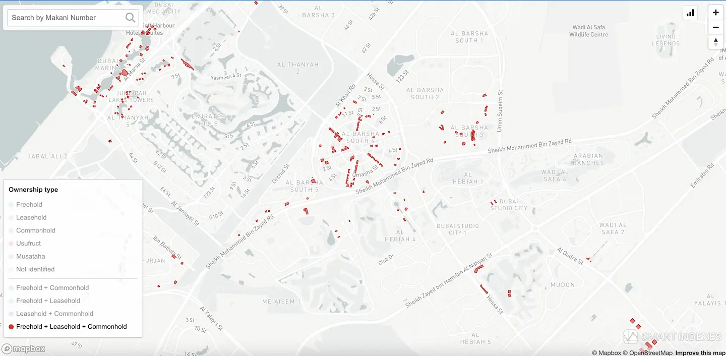 Chosen segment of combination "freehold" + "leasehold" + "commonhold" lands filtered to
next geoanalysis on map
Chosen segment of combination "freehold" + "leasehold" + "commonhold" lands filtered to
next geoanalysis on map
Summary for the selected building:
Property
Makani number: 29116 85176
Address: AL MERKADH - 347
Actual area: 3520.9 sq.m
Ownership type: Freehold + Leasehold + Commonhold
In this example presented that actual area is indicated with high accuracy:
Dubai Land Department records area data with precision up to two decimal places (i.e., centimeter-level accuracy).
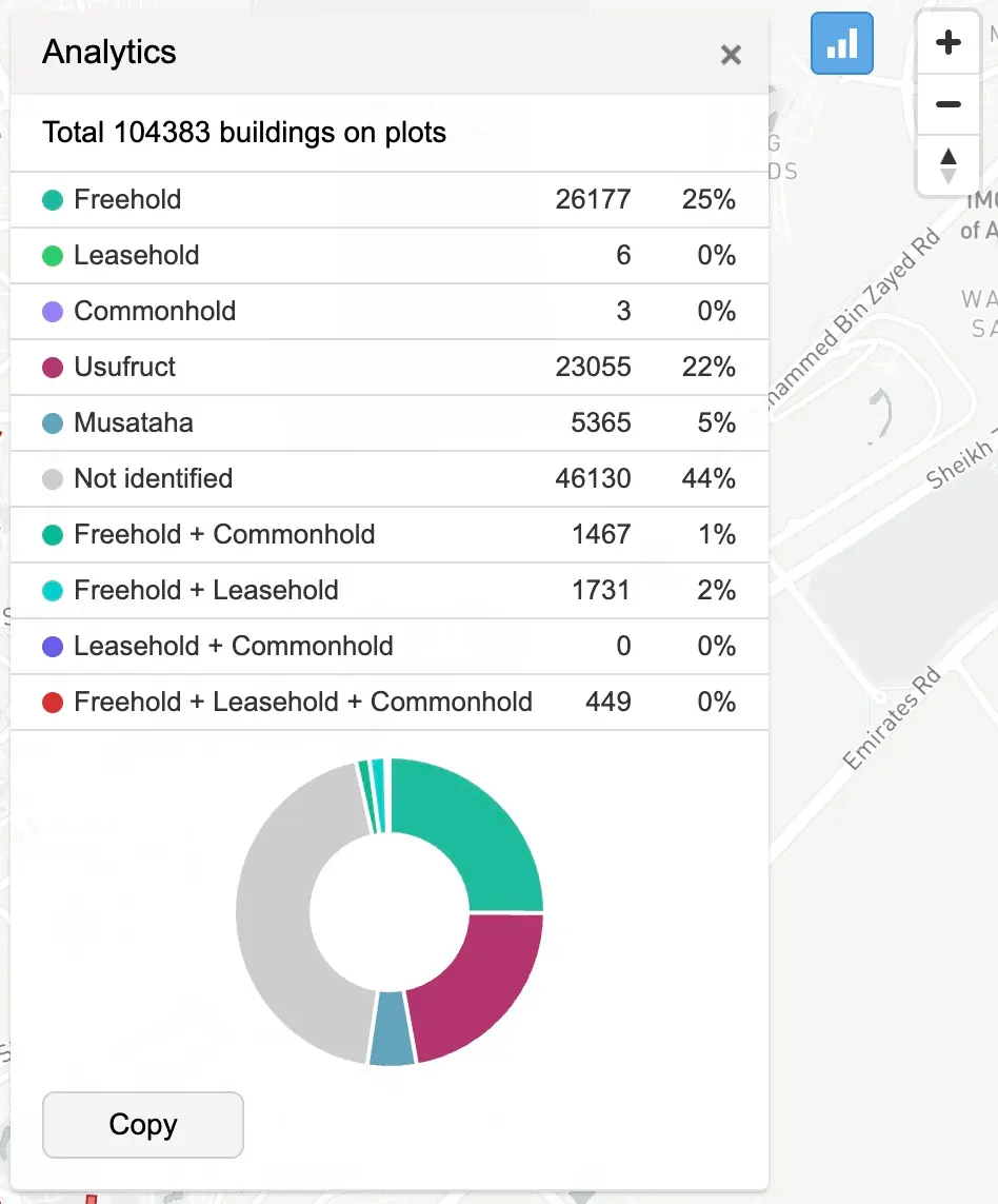 Property analytics in panel of UI from geoanalytical map
Key Features
The interactive map highlights:
-
Ownership type layers:
- Freehold
- Leasehold
- Commonhold
- Usufruct
- Musataha
- And their combinations.
- Filtering tool:
- Select one or multiple ownership types (e.g. Freehold + Commonhold).
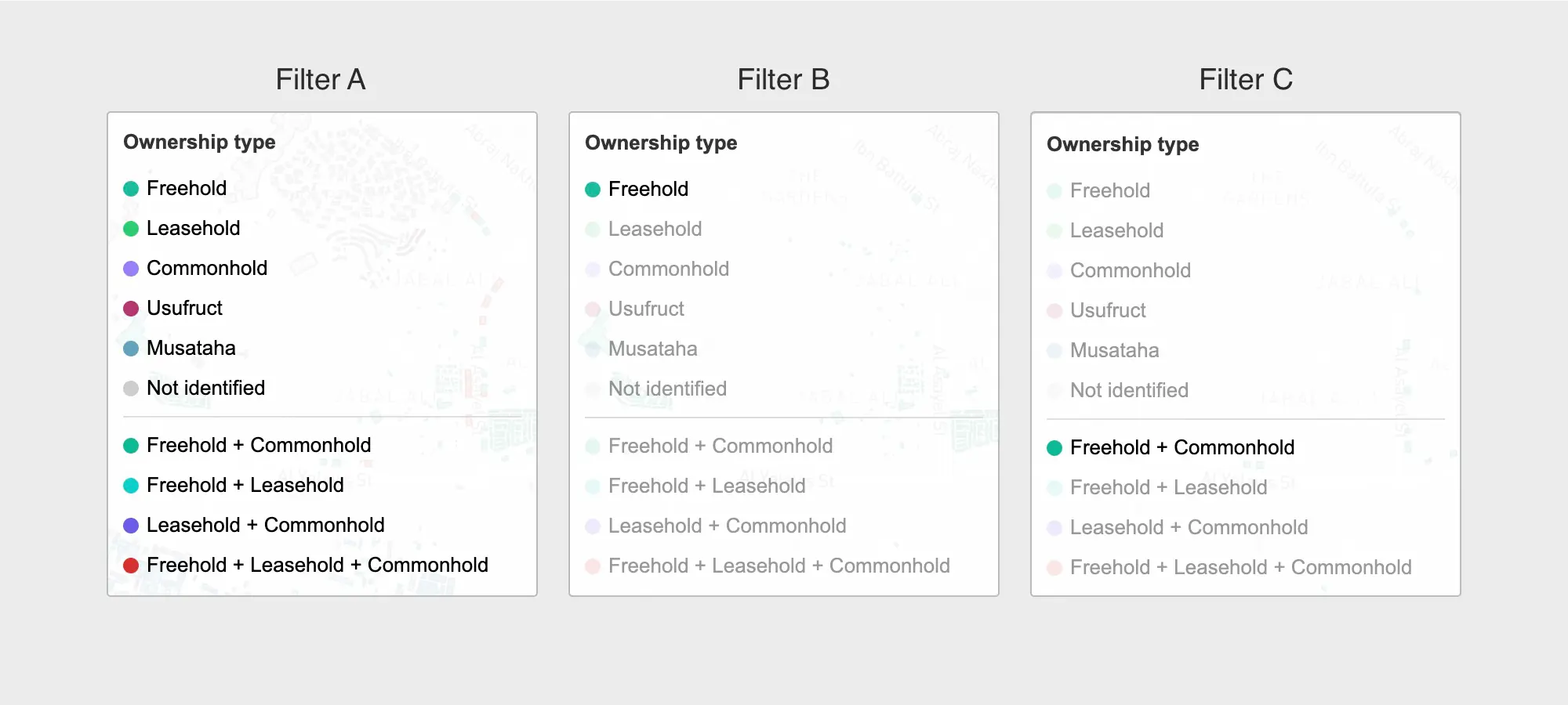 User interface: Filter segmentation land plots by ownership types
Map Interface Details
The left panel provides layer toggles for each form of ownership. Clicking on a toggle filters the map in real time to display parcels and buildings that match the selected legal form or combination of forms.
On screenshot "User interface: Filter segmentation land plots by ownership types" presents some of filters available to use on map to geoanalysis:
- Filter A: default view showing all ownership types and their combinations using color codes for identification.
- Filter B: shows only the Freehold segment”.
- Filter C: combination of ownership types presented on land plots and properties inside "Freehold" + "Commonhold" segment.
Read more in Smart Blog: Lands segmentation by type of ownership in Dubai
Deliverables
- GeoJSON "Land_Registry_Property_Segments.geojson" for integration in GIS platforms.
- API: endpoint "lands segmentation" (commercial access required).
- Methodology white paper available upon request.
Meeting Demo
A corporate demo is available upon request. Please contact Smart Indexes through our communication channels.
Subscribe to our Telegram channel and stay up to date with Smart Indexes updates.
Subscribe