Transport Accessibility Score for Dubai’s Buildings (Makani Number System)
This showcase is provided by Smart Indexes for informational purposes only. It demonstrates geoanalytics capabilities for business tasks in the Emirate of Dubai, including real estate investment and location screening, based on Smart Indexes empirical and analytical geo-data.
Technologies: Python OpenAI Microservices JavaScript GeoJSON Mapbox
The main objective of the transport accessibility index is to consolidate in percentage terms the key factors of walking and other accessibility of transport hubs near the entry point to the building, in order to further segment the buildings on the map by color levels for a complete characterization of both buildings and master development projects and communities of Dubai.
Transport Accessibility Score (TAS) is a composite index that evaluates the transport accessibility of a building from its door-level Makani Number (entry coordinates). TAS combines proximity to metro, distances to EV charging stations and the DXB/DWC airports, and the community-level Traffic Accident Rate (TAR). The result is visualized on a Dubai wide map to reveal both strengths and constraints of chosen locations.
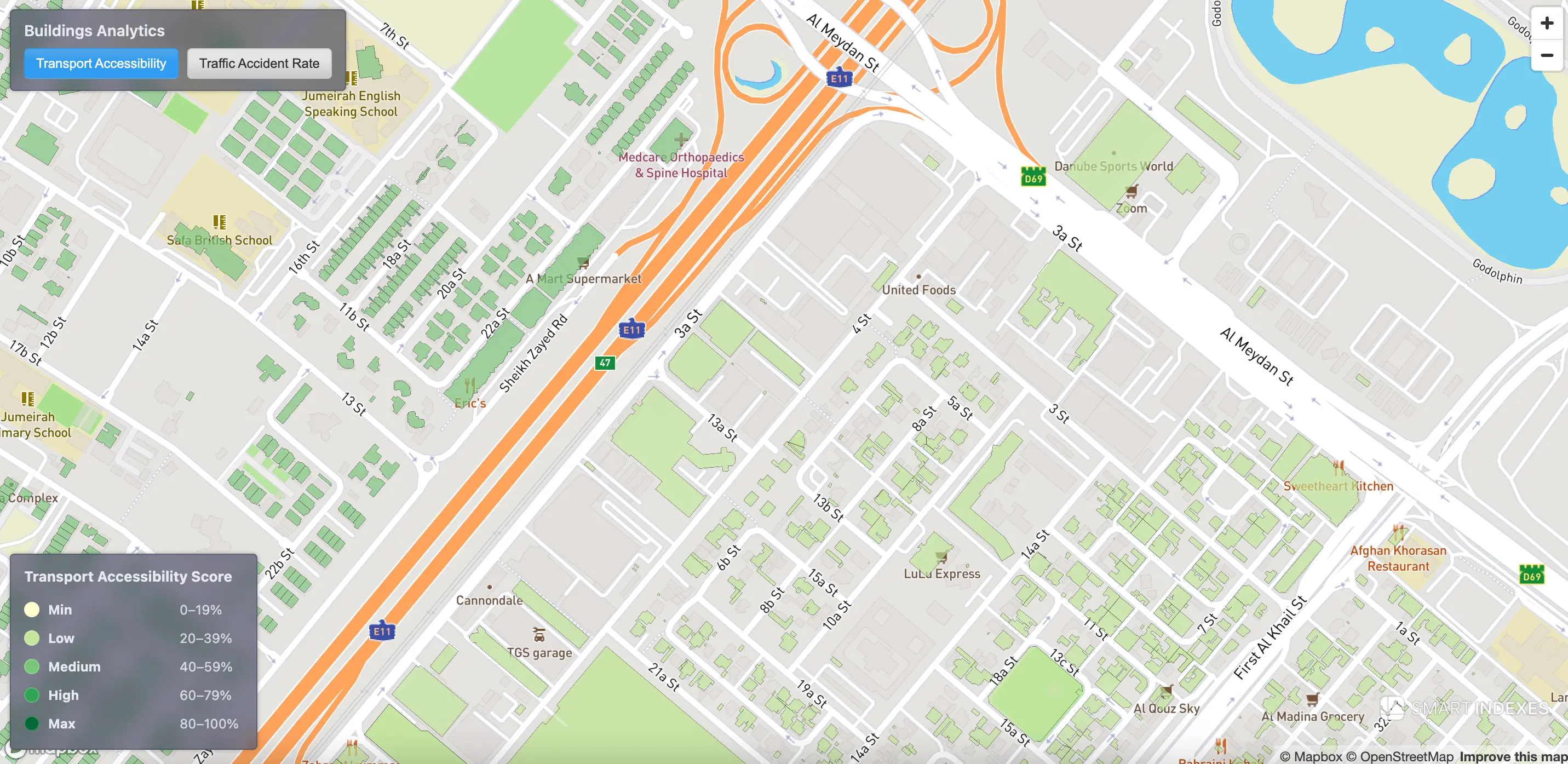 Transport Accessibility Score on Dubai’s map based on Makani Number and nearby transport hubs.
Case Overview
Choosing real estate by transport accessibility is critical for retail, logistics, and selecting a free economic zone for registration and office placement in Dubai. TAS ranks buildings for investment selection and location screening and supports visual geo-analysis at city, community, and building scales.
Transport Accessibility of Buildings: Factors
Smart Indexes calculates TAS for Dubai buildings using the Makani entry point as the anchor:
- Distance from the nearest metro station to the building entrance.
- Distance to EV charging stations.
- Distance to the international airports DXB and DWC.
- Community-level accident risk (TAR) as a negative factor.
The Makani Number system provides precise door-level coordinates for each building entrance, enabling accurate door-to-network distance measurements.
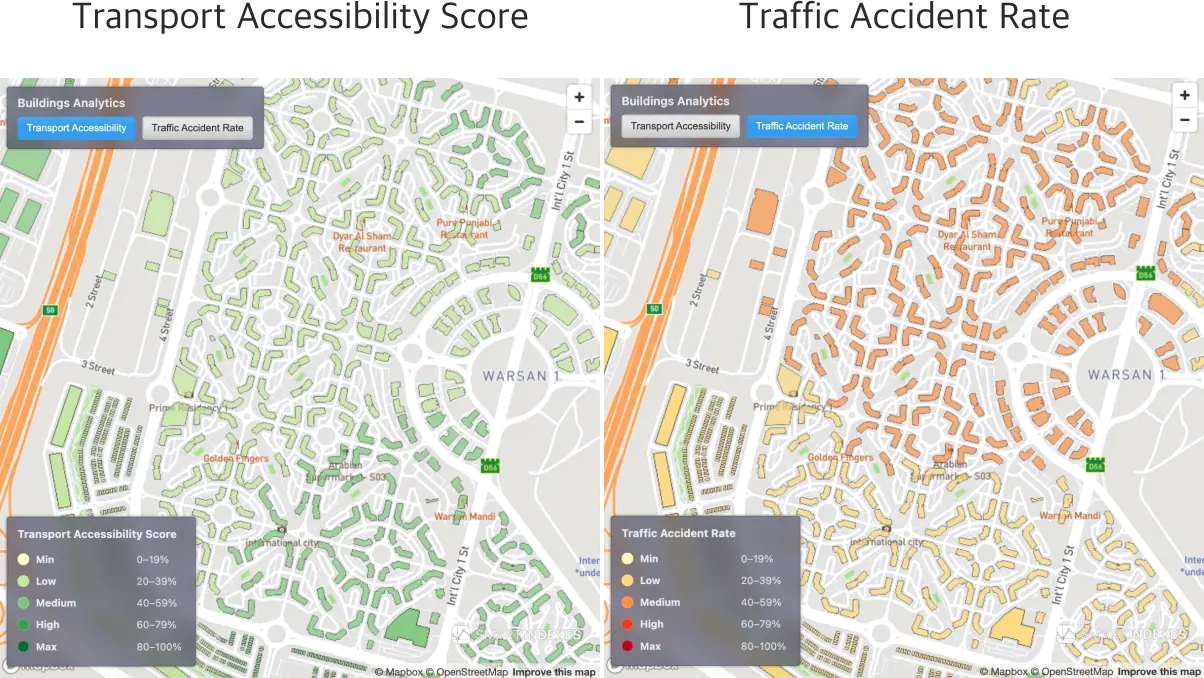 Transport Accessibility Score vs. Traffic Accident Rate on same location in community Warsan 1 of Dubai.
Aim of the Analysis
- Rank Dubai buildings by transport accessibility for investment and screening.
- Enable color-segmented geo-visualization by TAS level: city, community, and individual building (Makani).
Relation to PTAL (London)
TAS by Smart Indexes is an analogue of London’s PTAL, adapted to Dubai’s transport infrastructure and urban structure.
What TAS borrows from PTAL
- Door-level reference: measurement from the building entrance (Makani Number).
- Walk access to rapid transit (nearest metro within realistic walking distance).
- Map-friendly segmentation into accessibility bands for visual geo-analysis.
Dubai-specific differences
- Modal set: includes EV charging and airport access in addition to metro proximity.
- Safety context: incorporates community TAR as a negative factor.
- Anchor point: distances are computed from the Makani entry point.
- Resulted scale optimized for TAS map styling:
- min: 0-19%
- low: 20-39%
- medium: 40-59%
- high: 60-79%
- max: 80-100%
Note:
TAS is not PTAL and is not issued by Transport for London. It is an independent index by Smart Indexes, calibrated to Dubai’s urban logistics and climate.
TAS Calculation
The model weights distances to key transport hubs together with community accident risk (TAR) according to their relative importance for accessibility analysis. For corporate research, TAS can be customized — hub lists, weights, and additional factors can be tailored to a specific brief.
| TAS Level | Description |
|---|---|
| Max | Excellent metro/EV/airport proximity. Low TAR. |
| High | Strong multimodal access. TAR not constraining. |
| Medium | Balanced access. Some trade-offs by distance or TAR. |
| Low | Limited access or elevated TAR. |
| Min | Poor access and/or high TAR penalty. |
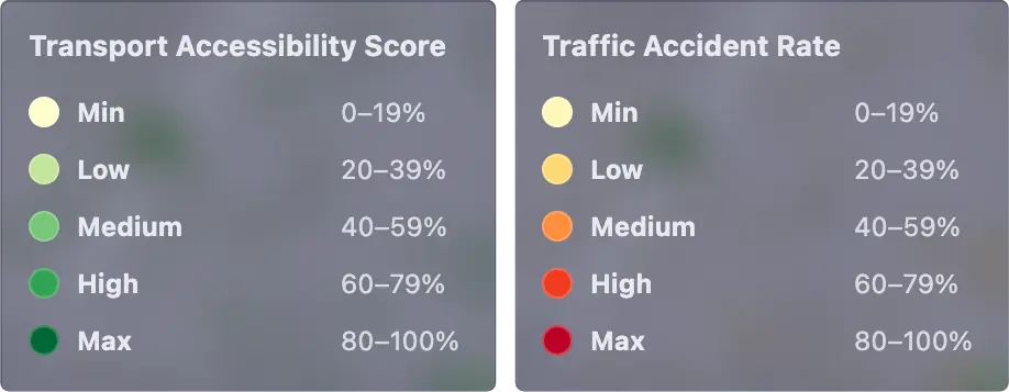 Map-friendly segmentation into five TAS levels for visual geo-analysis.
Makani Context
TAS relies on the Makani Number — a unique 10-digit code tied to a specific building entrance in Dubai — as a precise door-level anchor for distance computation and routing.
Learn more:
- Knowledge Base: Transport Accessibility Score
- Makani docs: Makani Search API
Request a Demo
A live demo is available upon request. Please contact Smart Indexes through our official channels.
Subscribe to our Telegram channel and stay up to date with Smart Indexes updates.
Subscribe